Are you dreaming of an unforgettable adventure in Vietnam? Then you need to discover Ha Giang! What is the topography of Ha Giang like? It’s a breathtaking landscape defined by highly mountainous terrain and karst plateaus, offering unparalleled views and thrilling experiences. SIXT.VN is your trusted partner, ensuring a seamless journey through this stunning region. Let us help you explore the dramatic landscapes and vibrant culture of this hidden gem in Vietnam, making your trip truly exceptional with our convenient travel solutions, including airport transfers and comfortable accommodations.
1. Understanding Ha Giang’s Topography: A Land of Majestic Mountains
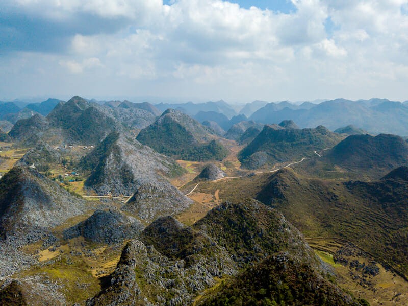
Ha Giang, Vietnam’s northernmost province, is renowned for its dramatic and diverse topography. The region’s landscape is primarily characterized by its rugged, highly mountainous terrain and karst plateaus. But what does that really mean for you, the traveler? Let’s break it down:
- Mountains Galore: Ha Giang is dominated by towering mountains, offering breathtaking panoramic views and challenging trekking opportunities. The mountains are not just visually stunning, but they also play a crucial role in shaping the region’s climate and ecosystems.
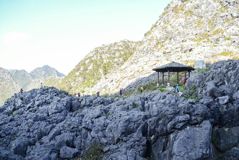
- Karst Plateau: The famous Dong Van Karst Plateau Geopark is a major feature, showcasing unique geological formations, deep canyons, and fascinating cave systems. This plateau is a testament to millions of years of geological activity.
- Deep Valleys and Gorges: Carved by rivers and streams over millennia, these valleys provide fertile land for agriculture and create dramatic scenic routes for travelers.
 Mountains Galore in Ha Giang
2. Why Is Ha Giang So Mountainous? The Geological Story
To truly appreciate Ha Giang’s topography, it’s helpful to understand its geological history. The region’s mountainous landscape is the result of millions of years of tectonic activity and erosion:
- Tectonic Forces: The collision of the Eurasian and Indian tectonic plates created the Himalayas and, indirectly, the mountain ranges of Northern Vietnam, including Ha Giang. These forces uplifted the land, creating the foundation for the region’s dramatic topography.
- Karst Formation: The karst plateaus are formed by the dissolution of soluble rocks, such as limestone, by water. Over time, this process creates underground drainage systems, caves, and the distinctive surface features of karst landscapes.
- Erosion: Weathering and erosion by wind and water have further sculpted the mountains and plateaus, creating the deep valleys and jagged peaks that characterize Ha Giang today.
3. The Dong Van Karst Plateau Geopark: A UNESCO Treasure
The Dong Van Karst Plateau Geopark, a UNESCO-recognized site, is a prime example of Ha Giang’s unique topography. It’s not just a pretty landscape; it’s a living museum of geological history and cultural heritage.
- Geological Significance: The plateau features a variety of rock formations dating back hundreds of millions of years, providing valuable insights into the Earth’s past. Fossils and geological structures tell the story of ancient marine environments and tectonic events.
- Biodiversity: Despite its rugged terrain, the plateau supports a surprising array of plant and animal life, adapted to the harsh conditions. Rare and endemic species can be found in the geopark’s forests and valleys.
- Cultural Heritage: The geopark is also home to diverse ethnic minority communities, each with their own unique traditions, languages, and ways of life. The local cultures are deeply intertwined with the landscape, shaping agricultural practices, architecture, and spiritual beliefs.
 Dong Van Karst Plateau
4. What Makes Ha Giang’s Karst Plateau Unique?
Ha Giang’s karst plateau is not just another rocky landscape; it possesses distinct characteristics that set it apart:
- High Altitude: The plateau sits at an average elevation of 1,000 to 1,600 meters above sea level, influencing its climate and vegetation. The high altitude also contributes to the stunning panoramic views and the sense of being on top of the world.
- Deep Canyons: The plateau is dissected by deep canyons, such as the famous Ma Pi Leng Pass, offering dramatic vistas and thrilling driving experiences. These canyons are a testament to the power of erosion and the region’s geological history.
- Stone Forests: Areas of the plateau feature “stone forests,” where jagged limestone formations rise dramatically from the ground, creating a surreal and otherworldly landscape.
5. How Does the Topography Affect Ha Giang’s Climate?
Ha Giang’s mountainous topography significantly influences its climate, creating distinct microclimates and weather patterns:
- Temperature Variations: Higher elevations experience cooler temperatures, while valleys tend to be warmer. This variation in temperature creates diverse habitats for plants and animals.
- Rainfall Patterns: The mountains intercept moisture-laden winds, resulting in higher rainfall in some areas and drier conditions in others. The rainy season typically lasts from May to October.
- Fog and Mist: The high mountains often trap fog and mist, creating a mystical atmosphere and influencing local agriculture.
6. Exploring Ha Giang’s Topography: Must-See Locations
Ready to experience Ha Giang’s stunning topography firsthand? Here are some must-see locations:
- Ma Pi Leng Pass: This legendary mountain pass offers breathtaking views of the deep canyons and towering peaks. It’s a challenging but rewarding drive or motorbike ride.
- Dong Van Old Quarter: A charming town nestled in the heart of the karst plateau, featuring traditional architecture and a vibrant local market.
- Lung Cu Flag Tower: Located near the Chinese border, this tower offers panoramic views of the surrounding mountains and valleys.
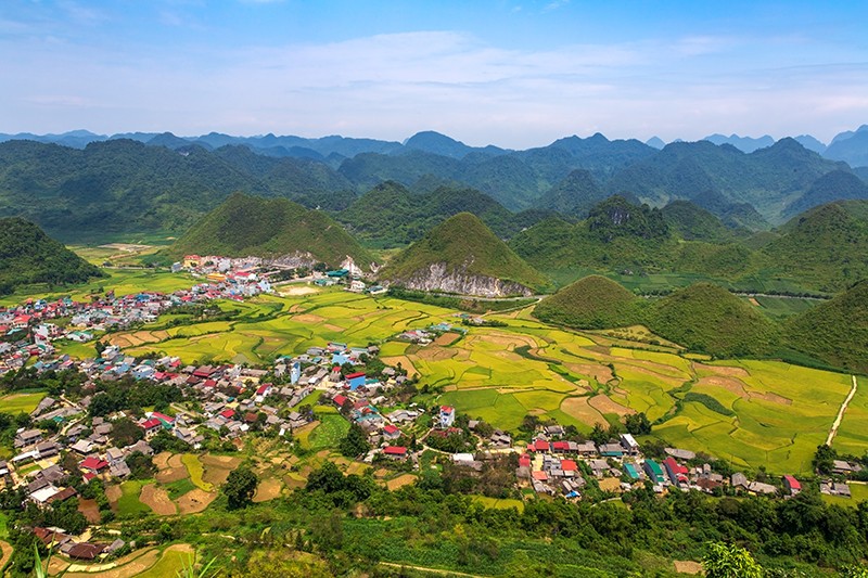
- Quan Ba Twin Mountains (Fairy Bosom): These unique conical hills are a striking feature of the landscape and are associated with local legends.
 Quan Ba Mountain – Quan Ba Heaven Gate
7. What Activities Can You Enjoy in Ha Giang’s Mountainous Terrain?
Ha Giang’s unique topography offers a wide range of activities for adventure seekers and nature lovers:
- Trekking and Hiking: Explore the mountains and valleys on foot, discovering hidden waterfalls, remote villages, and stunning viewpoints.
- Motorbiking: Ride along the winding mountain roads, experiencing the thrill of navigating the challenging terrain and enjoying the breathtaking scenery.
- Photography: Capture the dramatic landscapes, unique rock formations, and vibrant cultural scenes of Ha Giang.
- Cultural Immersion: Visit local villages, learn about the traditions of the ethnic minority communities, and experience their unique way of life.
8. Planning Your Trip: How to Navigate Ha Giang’s Topography
Traveling through Ha Giang’s mountainous terrain requires careful planning and preparation:
- Transportation: Motorbikes are a popular option for exploring the region, but it’s essential to have experience riding in mountainous terrain. Alternatively, you can hire a car or join a guided tour. SIXT.VN offers convenient and reliable transportation options to suit your needs.
- Accommodation: Choose accommodations that are strategically located for exploring the areas you want to visit. Consider staying in homestays for a more immersive cultural experience. SIXT.VN provides a range of accommodation options to fit your budget and preferences.
- Weather: Be prepared for varying weather conditions, especially if you’re traveling during the rainy season. Pack appropriate clothing and gear, including rain gear, warm layers, and sturdy hiking shoes.
- Physical Fitness: Trekking and motorbiking in Ha Giang can be physically demanding, so it’s essential to be in good shape.
9. Challenges of Ha Giang’s Topography: What to Be Aware Of
While Ha Giang’s topography is stunning, it also presents some challenges for travelers:
- Difficult Roads: The mountain roads can be steep, winding, and poorly maintained in some areas. Drive carefully and be aware of potential hazards.
- Altitude Sickness: The high altitude can cause altitude sickness in some individuals. Take it easy on your first day and drink plenty of water.
- Limited Infrastructure: Some areas of Ha Giang have limited infrastructure, including limited access to healthcare and other services.
10. How Does Ha Giang’s Topography Impact Agriculture?
Ha Giang’s topography profoundly influences the region’s agriculture, shaping the way local communities cultivate the land:
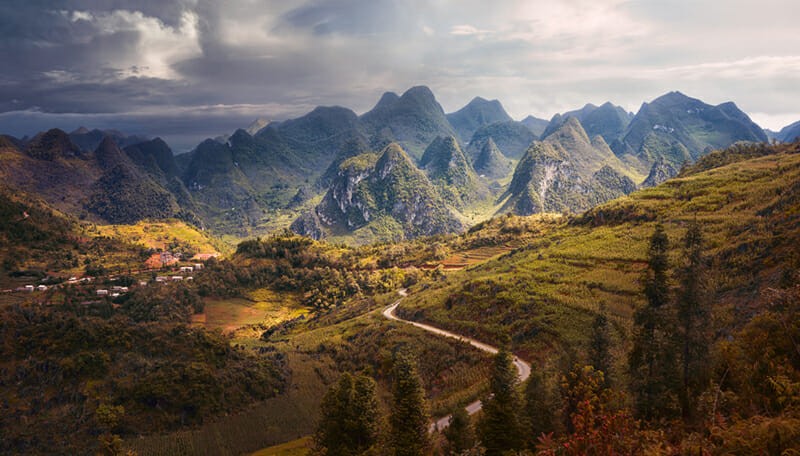
- Terraced Fields: The steep slopes of the mountains have been transformed into terraced fields, allowing farmers to grow rice and other crops. These terraced fields are not only functional but also create a beautiful and iconic landscape.
- Crop Selection: Farmers cultivate crops that are well-suited to the local climate and soil conditions, such as corn, buckwheat, and medicinal herbs.
- Water Management: Water management is crucial in this mountainous region. Farmers have developed ingenious irrigation systems to channel water from streams and springs to their fields.
 Terraced Fields
11. Cultural Adaptations to the Mountainous Environment
The ethnic minority communities of Ha Giang have adapted their cultures and lifestyles to the challenges and opportunities presented by the mountainous environment:
- House Construction: Traditional houses are often built on stilts to protect against moisture and pests. The materials used for construction are locally sourced, such as wood and stone.
- Clothing: The traditional clothing of the ethnic groups is designed to protect against the cold and rain. Bright colors and intricate embroidery are common features.
- Festivals: Many festivals are related to the agricultural cycle and the changing seasons. These festivals are a celebration of the community’s connection to the land.
12. What Role Does Topography Play in Ha Giang’s Tourism?
Ha Giang’s unique topography is a major draw for tourists, attracting visitors from around the world:
- Adventure Tourism: The challenging terrain provides opportunities for adventure activities such as trekking, motorbiking, and rock climbing.
- Ecotourism: The region’s diverse ecosystems and stunning landscapes are ideal for ecotourism, promoting sustainable travel and conservation.
- Cultural Tourism: The rich cultural heritage of the ethnic minority communities is another major attraction, offering visitors a chance to experience authentic local traditions.
13. How Can You Respect the Environment While Exploring Ha Giang?
As a responsible traveler, it’s essential to minimize your impact on the environment while exploring Ha Giang:
- Reduce Waste: Avoid single-use plastics and dispose of your trash properly.
- Conserve Water: Be mindful of your water usage, especially in areas where water is scarce.
- Respect Local Culture: Dress respectfully, ask for permission before taking photos, and be aware of local customs.
- Support Local Businesses: Choose locally owned accommodations, restaurants, and tour operators to support the local economy.
14. What Are the Best Times to Visit Ha Giang Based on the Topography?
The best time to visit Ha Giang depends on your interests and tolerance for different weather conditions:
- Spring (March-May): Pleasant temperatures and blooming flowers make this a popular time to visit.
- Autumn (September-November): Clear skies and cool temperatures offer ideal conditions for trekking and motorbiking.
- Winter (December-February): Can be cold, especially at higher elevations, but offers a unique opportunity to see the landscape covered in frost.
- Summer (June-August): The rainy season can make travel challenging, but the landscape is lush and green.
15. How Does SIXT.VN Enhance Your Ha Giang Experience?
SIXT.VN offers a range of services to make your trip to Ha Giang seamless and enjoyable:
- Airport Transfers: Start your adventure stress-free with our reliable and comfortable airport transfer service.
- Accommodation: Choose from a variety of hotels, guesthouses, and homestays to suit your budget and preferences.
- Tours: Join guided tours led by local experts to discover the hidden gems of Ha Giang.
- Transportation: Rent a car or motorbike to explore the region at your own pace.
16. Safety Tips for Navigating Ha Giang’s Mountain Roads
Driving or riding a motorbike on Ha Giang’s mountain roads requires extra caution:
- Check Your Vehicle: Ensure your vehicle is in good condition before setting out.
- Drive Slowly: Reduce your speed, especially on winding roads and steep inclines.
- Be Aware of Other Vehicles: Watch out for trucks, buses, and motorbikes.
- Wear a Helmet: Always wear a helmet when riding a motorbike.
- Avoid Night Driving: Driving at night can be particularly dangerous due to poor visibility.
17. Topography and the Ethnic Minorities: A Symbiotic Relationship
The topography of Ha Giang is inextricably linked to the lives and cultures of the ethnic minority communities who call this region home:
- H’mong People: The H’mong people are the largest ethnic group in Ha Giang. They are known for their terraced farming techniques, their colorful traditional clothing, and their unique customs.
- Dao People: The Dao people are skilled artisans and farmers. They are known for their intricate embroidery, their traditional medicine, and their herbal remedies.
- Tay People: The Tay people are known for their traditional music, their stilt houses, and their distinctive cuisine.
18. How Does Ha Giang’s Topography Contribute to Its Unique Biodiversity?
Ha Giang’s diverse topography creates a variety of habitats that support a rich array of plant and animal life:
- Forests: The mountains are covered in lush forests, providing habitat for a variety of mammals, birds, and reptiles.
- Valleys: The valleys are home to fertile agricultural land and diverse plant life.
- Rivers and Streams: The rivers and streams support a variety of aquatic species, including fish, amphibians, and invertebrates.
19. Sustainable Tourism in Ha Giang: Preserving the Topography for Future Generations
Sustainable tourism is essential for preserving Ha Giang’s unique topography and cultural heritage for future generations:
- Support Local Communities: Choose locally owned businesses and services to support the local economy.
- Respect the Environment: Minimize your impact on the environment by reducing waste, conserving water, and avoiding damaging fragile ecosystems.
- Educate Yourself: Learn about the local culture and environment to better appreciate the region’s unique features.
20. Ha Giang’s Topography: A Landscape Shaped by Time and Culture
Ha Giang’s topography is not just a geological feature; it’s a landscape shaped by time, culture, and the forces of nature. It’s a place where majestic mountains meet vibrant cultures, offering a truly unforgettable travel experience. Let SIXT.VN be your guide to discovering the wonders of Ha Giang.
21. Are there any unique geological formations in Ha Giang?
Yes, Ha Giang is renowned for its unique geological formations, most notably the Dong Van Karst Plateau Geopark. This UNESCO-recognized site features:
- Karst Landscapes: Characterized by limestone formations, sinkholes, caves, and underground drainage systems.
- Rock Formations: Dating back hundreds of millions of years, showcasing the Earth’s geological history.
- Stone Forests: Jagged limestone formations rising dramatically from the ground.
22. What is the average elevation of Ha Giang’s mountainous areas?
The average elevation in Ha Giang ranges significantly depending on the specific area. Generally:
- Dong Van Karst Plateau: Sits at an average elevation of 1,000 to 1,600 meters (3,280 to 5,250 feet) above sea level.
- Overall Mountainous Areas: Elevations can vary from a few hundred meters in the valleys to over 2,000 meters (6,560 feet) on the highest peaks.
23. How does the topography of Ha Giang affect transportation?
The rugged topography of Ha Giang significantly impacts transportation:
- Road Conditions: Roads are often winding, steep, and can be poorly maintained, making travel challenging.
- Accessibility: Some remote areas are difficult to access, requiring specialized vehicles or modes of transport like motorbikes.
- Travel Time: Distances can be deceptive; what looks like a short distance on a map can take hours to traverse due to the terrain.
24. What kind of rock formations are predominant in Ha Giang?
The predominant rock formations in Ha Giang are:
- Limestone: Dominates the Dong Van Karst Plateau, contributing to the unique karst landscape.
- Sedimentary Rocks: Including shale and sandstone, found in various parts of the province.
- Other Minerals: Small deposits of minerals like manganese and antimony are also present in some areas.
25. How does Ha Giang’s topography influence its agricultural practices?
The topography of Ha Giang profoundly shapes its agricultural practices:
- Terraced Farming: Steep mountain slopes are transformed into terraced fields to cultivate rice and other crops.
- Crop Selection: Local farmers grow crops well-suited to the climate and soil conditions, such as corn, buckwheat, and medicinal herbs.
- Irrigation Systems: Ingenious water management systems are used to channel water from streams and springs to the fields.
26. Are there any natural hazards associated with Ha Giang’s topography?
Yes, Ha Giang’s topography makes it susceptible to several natural hazards:
- Landslides: Steep slopes and heavy rainfall can trigger landslides, especially during the rainy season.
- Flash Floods: Deep valleys and narrow river channels can lead to flash floods after heavy rain.
- Erosion: The karst landscape is prone to erosion, which can damage infrastructure and agricultural land.
27. What are the major rivers and valleys in Ha Giang?
Major rivers and valleys in Ha Giang include:
- Lo River: The largest river in the province, carving deep valleys and providing water for agriculture.
- Gam River: Another significant river that flows through the province, contributing to the landscape’s diversity.
- Valleys: Numerous smaller valleys formed by streams and rivers, creating fertile areas for cultivation.
28. How has the local population adapted to Ha Giang’s mountainous topography?
The local population has adapted in numerous ways:
- Building Techniques: Traditional houses are often built on stilts to protect against moisture and pests, using locally sourced materials.
- Farming Practices: Terraced farming and crop selection are tailored to the mountainous environment.
- Cultural Traditions: Traditional clothing and festivals often reflect the connection to the land and the challenges of mountain life.
29. What is the significance of the Quan Ba Twin Mountains in relation to Ha Giang’s topography?
The Quan Ba Twin Mountains (also known as Fairy Bosom) are significant because:
- Unique Landscape Feature: They are striking conical hills that stand out in the landscape.
- Local Legends: They are associated with local legends, adding cultural significance to the natural topography.
- Tourist Attraction: They are a popular destination, drawing visitors to admire their beauty and learn about their stories.
30. How does the topography of Ha Giang compare to other mountainous regions in Vietnam?
Ha Giang’s topography is distinct compared to other mountainous regions in Vietnam:
- Karst Plateau: The presence of the Dong Van Karst Plateau is unique to Ha Giang.
- Ruggedness: It is considered one of the most rugged and remote areas in Vietnam, with steeper slopes and more challenging terrain than regions like Sapa.
- Geological History: The rock formations and geological history of Ha Giang are particularly well-preserved and significant, making it a global geopark.
Discover the beauty and adventure that await you in Ha Giang with SIXT.VN!
Ready to explore the breathtaking topography of Ha Giang? Contact SIXT.VN today to plan your unforgettable journey! Visit our website at SIXT.VN or call our hotline/WhatsApp at +84 986 244 358. Our address is 260 Cau Giay, Hanoi, Vietnam. Let us take care of your airport transfers, accommodation, tours, and transportation needs. Experience the convenience and reliability of SIXT.VN and make your Ha Giang adventure a dream come true!


